


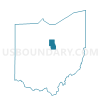
SHARON TOWNSHIP, Richland County, Ohio
About
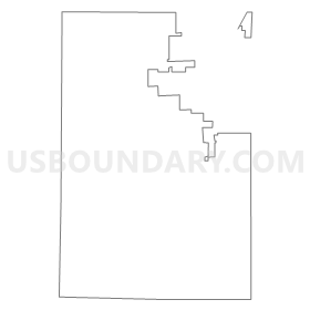
Outline
Summary
| Unique Area Identifier | 651296 |
| Name | SHARON TOWNSHIP |
| County | Richland County |
| State | Ohio |
| Area (square miles) | 20.18 |
| Land Area (square miles) | 20.15 |
| Water Area (square miles) | 0.03 |
| % of Land Area | 99.85 |
| % of Water Area | 0.15 |
| Latitude of the Internal Point | 40.85456090 |
| Longtitude of the Internal Point | -82.69380300 |
Maps

Graphs
Select a template below for downloading or customizing gragh for SHARON TOWNSHIP, Richland County, Ohio


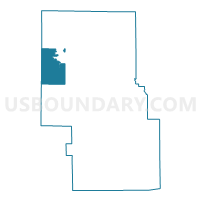
Neighbors
Neighoring Voting District (by Name) Neighboring Voting District on the Map
- CASS A, Richland County, OH
- JACKSON TOWNSHIP A, Richland County, OH
- JACKSON TOWNSHIP B, Richland County, OH
- Voting District Jackson Twp, Crawford County, OH
- PLYMOUTH TOWNSHIP B, Richland County, OH
- SANDUSKY TOWNSHIP, Richland County, OH
- SHELBY WARD 1 PREC A, Richland County, OH
- SHELBY WARD 1 PREC B, Richland County, OH
- SHELBY WARD 2 PREC A, Richland County, OH
- SHELBY WARD 2 PREC B, Richland County, OH
- SHELBY WARD 3 PREC A, Richland County, OH
- SHELBY WARD 4 PREC A, Richland County, OH
- SHELBY WARD 4 PREC B, Richland County, OH
- SPRINGFIELD TOWNSHIP A, Richland County, OH
- SPRINGFIELD TOWNSHIP C, Richland County, OH
- Voting District Vernon Twp, Crawford County, OH
Top 10 Neighboring County Subdivision (by Population) Neighboring County Subdivision on the Map
- Springfield township, Richland County, OH (10,685)
- Sharon township, Richland County, OH (9,125)
- Jackson township, Richland County, OH (3,552)
- Plymouth township, Richland County, OH (2,083)
- Cass township, Richland County, OH (1,647)
- Sandusky township, Richland County, OH (993)
- Vernon township, Crawford County, OH (832)
- Jackson township, Crawford County, OH (381)
Top 10 Neighboring Place (by Population) Neighboring Place on the Map
Top 10 Neighboring Unified School District (by Population) Neighboring Unified School District on the Map
- Shelby City School District, OH (13,087)
- Ontario Local School District, OH (11,025)
- Buckeye Central Local School District, OH (5,473)
- Crestline Exempted Village School District, OH (5,427)
- Plymouth-Shiloh Local School District, OH (5,217)
Top 10 Neighboring State Legislative District Lower Chamber (by Population) Neighboring State Legislative District Lower Chamber on the Map
- State House District 90, OH (126,807)
- State House District 82, OH (111,625)
- State House District 73, OH (105,536)
Top 10 Neighboring State Legislative District Upper Chamber (by Population) Neighboring State Legislative District Upper Chamber on the Map
Top 10 Neighboring 111th Congressional District (by Population) Neighboring 111th Congressional District on the Map
Top 10 Neighboring Census Tract (by Population) Neighboring Census Tract on the Map
- Census Tract 23, Richland County, OH (6,314)
- Census Tract 27, Richland County, OH (5,242)
- Census Tract 26, Richland County, OH (4,921)
- Census Tract 25, Richland County, OH (4,204)
- Census Tract 28, Richland County, OH (3,730)
- Census Tract 9741, Crawford County, OH (3,666)
- Census Tract 9748, Crawford County, OH (2,221)